|

About Sunset Park, Brooklyn
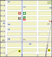
Sunset Park is a diverse working class community composed primarily of Hispanics, Orthodox Jews, and Chinese. The neighborhood is located south of Greenwood Cemetery separating it from its more affluent Park Slope neighbors to the north, with the Gowanus Expressway separating Sunset Park from quiet Bay Ridge to the south. The commercial strip of Sunset Park Chinatown is centered on 8th Ave and 59th St radiating outward primarily along 8th ave, 7th Ave, and Ft. Hamilton.
In Chinese, the word "eight" sounds like the word for "prosperity", and "Eight Avenue" can be construed as a sort of "Road to prosperity." It sounds as if Chinatown is some sort of gritty frontier town cashing in on a gold rush, and in many ways it is.
To get there, take the N train to the 8th Avenue stop.
Last updated 31 May 2009, what's new?
紐約 八大道 唐人街 中國城 華埠 地圖
|
|